Included With Lots 2, 3 & 4
Very Special Deeded Easements
Lot 2, Lot 3 and Lot 4 are FOR SALE BY OWNER. Lot 2, Lot 3 and Lot 4 are being sold with very special easements to the ocean & beach/rocky point along Cabbage Point, and to both North and South beaches near Cabbage Point (5 ft above high-water mark easement).
Additional easements included in the future (deed) conveyance include a 20 ft wide road from rear of the property to Cabbage Point (south of Lots), a nature trail that leads between Lot 2 and Lot 3/Lot 4 and then along North edges of Lot 2 and Lot 1 to Cabbage Point ("L" shaped nature trail/path shown on Survey Drawing), and a 60 ft wide road reservation from rear of these properties at Cabbage Point back to the Queens Highway (in the vicinity of Pratt's property on the Queens Highway).
Easements Included in Each Conveyance
-
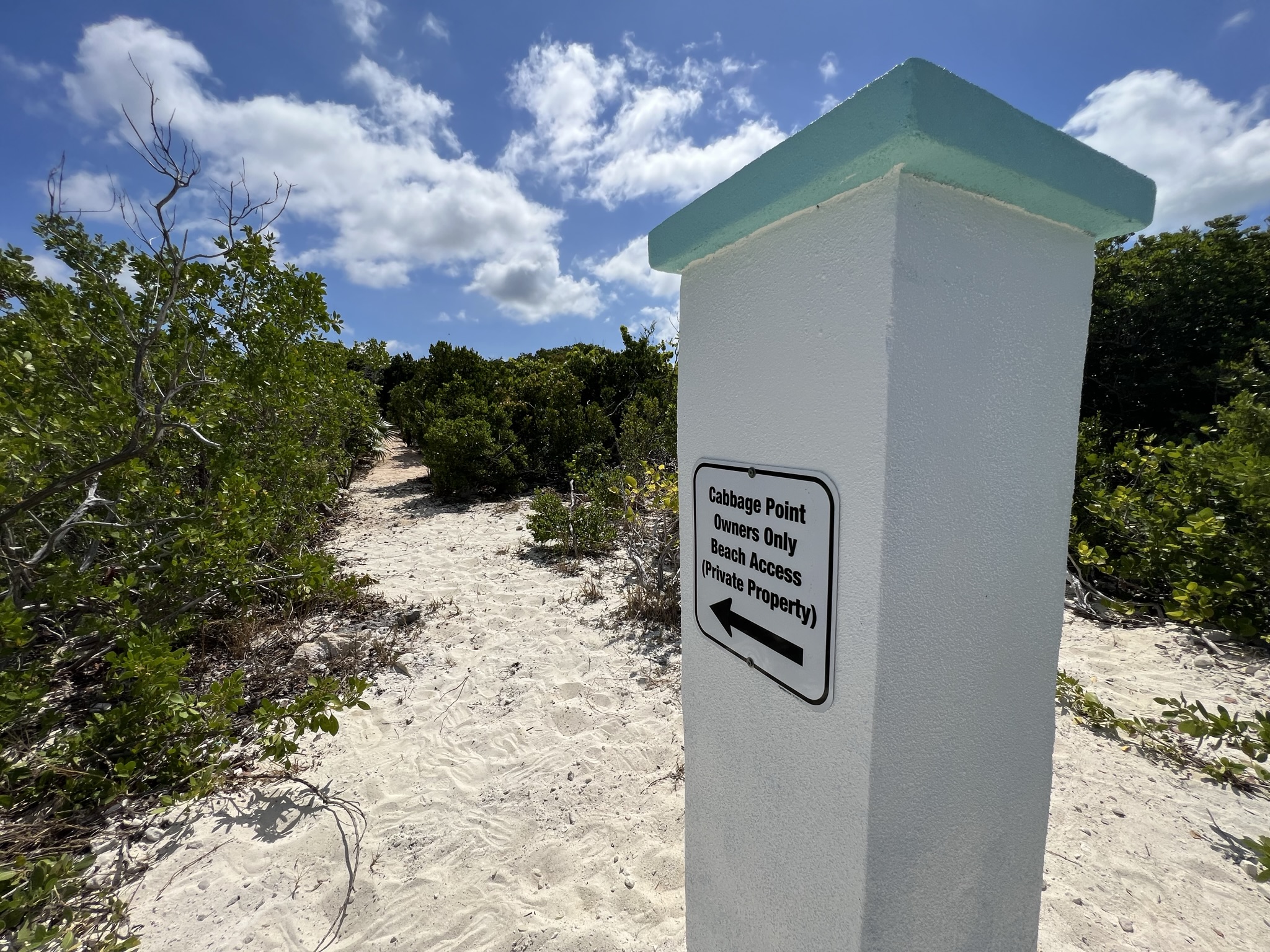
Sandy Beach Path Access Easement (Nature Trail)
Between Lot 2 and Lot 3/Lot 4, and alongside Lot 2 to Cabbage Point — an "L" shaped nature trail/path as shown on the Survey Drawing (Easement E–F–B). -
5 ft Above High-Water Mark Beach Easement (~1,700 ft / ~0.32 miles)
Right-of-way access easements along beach (A–B–C–D) to Cabbage Point rocky point, as well as to both a gorgeous North Beach and South Beach — perfect for swimming (Easement A–B–C–D). -
20 ft Wide Road Reservation & Sandy Beach Access Path
From rear of the properties south to Cabbage Point (Easement C–E). Buried underground electrical access from existing buried boxes runs along this 20 ft road reservation. -
60 ft Wide Road Reservation to Queens Highway
From rear of the Cabbage Point properties back to the Queens Highway (in the vicinity of Pratt's property on Queens Highway) — providing full legal road access to all lots from the public highway.
For more information on easements, see detailed diagrams including survey drawings in the Slide Show (PowerPoint® Presentation) created by the Vendor, which is downloadable on this web site. A full survey plan is also available for download here.